
Find a Palmer Township Street Directory Record
An address question in Palmer Township works best as an address trail. First, standardize the address with the Postal Service. Then use the county property record when its Address path is available to identify the tax parcel. The parcel and its location field lead to a mapped feature, while the map and recorded document provide a way to test whether separate records concern the same land. A tax or assessment owner is a recorded administrative field, not proof of every current household member. Preserve the date and the record key at every step.
- Use the USPS ZIP Lookup to standardize the known mailing address before comparing county records.
- Open the Northampton County Public Access property record by Address when the live service is available, then note the parcel and assessment identifiers it exposes.
- Check the same feature in the Northampton GIS parcel service for its location, map, block, lot, municipality, sale, and deed-reference fields.
- Use a recorded party or reference to search LANDEX, and compare the legal description with the mapped parcel before treating the instrument as a match.
- For a permitted election question, ask Northampton County Elections about its inspection or request rules; for a dated household lead, ask the Marx Room about cross-reference directories.
Note: A street name alone can be ambiguous on a private road, a corner parcel, or a tract that has been subdivided.
Palmer Township Parcel Fields by Street
The public GIS service has a documented parcel schema even though the county property screen was in maintenance during research. Use its returned fields to connect an address to one mapped tax feature. They are records about land and assessment, not a roster of people. The service joins parcel geometry to assessment data through the CAMA ID, and its location field is a situs, or physical parcel, field rather than verified mail-delivery information.
| GIS field | What it identifies | How it helps a street search |
|---|---|---|
| Parcel ID and CAMA ID | County parcel and assessment keys | Keep both identifiers with the address result. |
| Location | Physical parcel location | Connects a street address to a map feature, not a mailing address. |
| Map, Block, and Lot | Tax-map or subdivision components | Tests a deed's legal description against the parcel. |
| Municipality and School District | Geographic context | Helps distinguish similarly named streets and nearby features. |
| Deed, sale date, and sale price | Transaction leads | Points to a Recorder check rather than replacing the deed image. |
The Northampton GIS parcel service is shown in this Palmer Township address-record image.
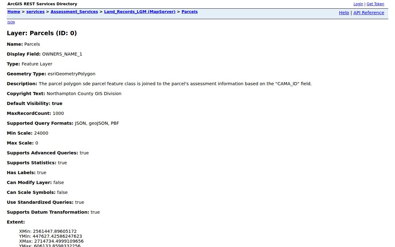
Parcel geometry and fields such as location, map, block, lot, and deed reference make the service useful for comparing address records without treating a map result as occupancy evidence.
Palmer Township Street Record Coverage
Each office keeps a different part of the address trail. The county assessment channel can identify a tax parcel. GIS places that parcel and returns its land attributes. The Recorder confirms a recorded transaction, while township planning material can place a development, permit, or public meeting in time. Election street lists have a separate statutory purpose and access rule. A historical cross-reference book can offer a dated address-to-name lead when the selected volume supports it.
| Address record | Custodian | Street question answered | Access and limit |
|---|---|---|---|
| Street classification map | Palmer Township | Where a road, route, park, or boundary appears | Orientation only, not parcels or residents. |
| Property record | Northampton Assessment | Which tax parcel corresponds to an address | Detailed live filters were unavailable during maintenance. |
| GIS parcel service | Northampton GIS | Boundary, location, map/block/lot, sale and deed leads | Land feature, not a household list. |
| Recorded instrument | Recorder of Deeds | Recorded parties, references, and legal description | LANDEX index, paid image, courthouse-certified copy. |
| Planning or permit material | Palmer Township | Plan, construction, or approval chronology | Counter, meeting record, or focused RTKL route. |
| Election street list | Northampton County Elections | Registered electors arranged by street and house number | Office safeguards and statutory permitted-use limits apply. |
| Cross-reference directory | Easton Area Public Library Marx Room | Historical listed name by address in selected editions | Confirm the year and reverse-directory coverage with staff. |
This is why address research should keep records separate. A plan applicant, recorded party, assessment owner, and listed directory name can all be different people or roles tied to the same location at different times.
Palmer Township Property Search Maintenance
The Northampton County Assessment channel links to a county public-access page with Address, Parcel, Sales, Advanced, and Map Search paths. Its detailed form was blocked by a maintenance notice during the research pass. That gap matters. It means a careful search should not promise an owner-name field, a mailing-address filter, or a ZIP filter until the live screen exposes those controls again. The county describes the data as read-only tax-record information and warns that its accuracy and currency are not guaranteed.
The county assessment page is shown in this Palmer Township address-record image.
When the public screen is unavailable, use a parcel key with GIS, contact Assessment for the tax-record route, or move to the Recorder for a recorded-document question. A focused Pennsylvania Right-to-Know request can seek an existing township permit or plan record, but it does not require the township to create an address history.
Note: Recheck the live property interface before relying on any control or result field not documented by the maintenance-screen research.
Palmer Township Streets on the 2025 Map
The 2025 Street Classification Map gives the local geography that a plain address search lacks. It has an alphabetical street index, an A through H and 1 through 21 grid, road classifications, township boundaries, parks, trails, and PennDOT route labels. William Penn Highway, Freemansburg Avenue, Tatamy Road, Newburg Road, Main Street, and Stones Crossing Road appear with state-route context. Use that material to recognize a spelling, route label, nearby park, or subdivision description in a deed or plan.
The map is an orientation tool, not a person locator. Its mix of local roads, collector roads, private roads, and state highways also cautions against assuming a simple rectangular street grid or a universal numbering origin. The research did not find an official townshipwide renumbering history, so an unverified renumbering claim should not be used to explain an address mismatch.
Palmer Township Deed Trails Through LANDEX
Recorded deeds are party and legal-description records, not a universal house-number index. Once a parcel and current transaction lead are in hand, LANDEX WebStore can search Northampton in General mode by company or last name, first name, date range, and document type. It also has separate County plus Instrument Number and County plus Book Number and Page Number modes. A person search needs a first-name entry. The portal supports ? for one character and * for a string, although a name search stops at 250 matches.
| LANDEX result or reference | Use it carefully |
|---|---|
| Party or company name | A searchable recorded-party lead, not current residence proof. |
| Document type and date | Separates deeds, mortgages, satisfactions, wills, and other instruments. |
| Instrument or book/page reference | Retrieves one specific indexed record and supports a counter request. |
| Municipality and legal description | Compare them with map/block/lot, acreage, subdivision, or boundaries. |
| Image and certification route | Paid PDFs arrive through the WebStore; certified copies come from the courthouse. |
The LANDEX document-search screen is shown in this Palmer Township address-record image.
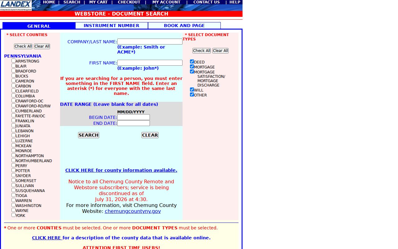
Search access and image access are separate. A selected document goes to a cart, checkout uses a credit card with a $5 processing fee, and liens belong with the Prothonotary rather than the Recorder.
Palmer Township Planning Records by Address
For a location-specific construction, zoning, subdivision, or public-plan question, use Palmer Township Planning, the permit and planning material on the township forms page, public meeting records, or the township's open-records route. The right request identifies the street address, parcel or CAMA ID if known, a time span, and a record type such as a final permit card, certificate of occupancy, approved subdivision plan, or cited plan sheet. Planning files can date an event, but an applicant may be an owner, contractor, or authorized representative.
The Palmer Township Planning page is shown in this Palmer Township address-record image.
Individual home work generally follows administrative zoning or construction permits, while larger projects move through public Planning Commission or Board processes. That distinction helps identify the best custodian without turning public planning material into a resident list.
Palmer Township Election Street Lists
Pennsylvania Election Code Section 1403 requires pre-election street lists arranged by street and house number, alphabetically, or in another way that identifies a voter's residence location. Two copies stay on file at the commission for public inspection during regular office hours, subject to safeguards. That is a distinct route from the state voter-status form, which checks an individual registration match with county, name, and date of birth. It is not an online mass-browse address list.
Northampton County Elections is at the County Government Center in Easton and can explain inspection or written-request procedures. Sections 1207 and 1404 limit voter-list use to elections, political activities, or law enforcement and require identification and a written use statement for list access. Signatures and SURE registration numbers are excluded. An inactive registration also does not establish that someone has left an address.
Note: Election participation history says whether and when a person voted, never how that person voted in a ballot.
Palmer Township Historic Street Listings
For an older address-to-name lead, the Easton Area Public Library's Marx Room holds Easton-area phone and cross-reference directories alongside city directories, newspapers, maps, census material, church and cemetery resources. Begin with the exact house number and the printed street spelling in a selected cross-reference or reverse directory. Then check the alphabetical directory and census material for the same period. The library's regional scope matters because older or nearby material may be indexed under Easton, Northampton County, or former Forks Township rather than the modern township label.
The public brochure confirms Easton city directories beginning in 1855, but it does not publish a complete online inventory of reverse-directory editions. Confirm a selected year's coverage at the shelf or with staff before relying on it. The historical collection itself is covered in the Palmer Township Directory Book; this address use is limited to the address-to-name question.
Palmer Township Street Terms to Know
Matching records requires using each address term for its actual purpose. These short definitions keep a map feature, delivery address, and recorded tract from being merged into one unsupported claim.
- Parcel
- A tax-map unit of land identified by county keys such as Parcel ID or CAMA ID.
- Situs address
- The physical location of a parcel, which can differ from an address used to receive mail.
- Plat or plan
- A recorded or approved drawing that lays out lots, roads, or subdivision details.
- Criss-cross directory
- A directory arranged by address rather than alphabetically, when an edition includes that format.
Palmer Township Street Record Boundaries
The records in an address trail can document a parcel, a recorded party, a public plan, or a historical listing. They cannot establish every person living at a location. Non-owner household members are not automatically indexed in land records. Utility customer lists are not public address rolls, and personal DMV address data is protected under the federal Driver's Privacy Protection Act. A mapped sequence of parcels also does not prove that people share a household, social connection, or organization.
Pennsylvania's Address Confidentiality Program can provide qualified participants a substitute mailing address across listed government and public-service records. A substitute address is not an error to override with a guessed location. When an official record needs correction, preserve the record identifier and contact the custodian that created it.
Palmer Township Street Deed Alert Checks
For an owner's own property, the Recorder-linked Northampton LANDEX Record Alert offers free county-only monitoring by registered name or parcel/UPI number. The service allows five names and five parcel or UPI numbers for each email or phone combination. Its notice can include the matching name, recording date, instrument number, instrument type, and municipality. It is a narrow monitoring tool, not identity confirmation.
The Pennsylvania Attorney General's February 2026 deed-fraud warning makes the verification step important. A common legal name can produce unrelated alert matches. Check the instrument, municipality, parcel, and legal description through LANDEX or the Recorder before assuming a recorded event concerns the same tract.
Palmer Township Street History Before 1857
Older land research has a local geography trap. Palmer Township was part of Forks Township until a court order on May 5, 1857. A pre-1857 deed, tax assessment, survey, or repository description may therefore use Forks Township even when the land lies in present Palmer Township. George Palmer served as Northampton County deputy surveyor from 1773 for about 51 years, and his survey work remains relevant to title and boundary questions. That history gives older map, tract, and survey language real value in a property comparison.
Northampton's historic record trail is deep but layered: the State Archives guide documents Recorder deeds from 1752 to 1866 and grantor/grantee index volumes from 1752 to 1926. County Archives holds records from more than 30 offices across 48 filing systems and directs house historians to grantor/grantee indexes at Archives, the Recorder, or LANDEX. Treat those dates as source coverage, not a promise that every volume is digitized or searchable by a modern street number.